


A Linkage Network for the California Deserts
From the Science and Collaboration for Connected Wildlands and Northern Arizona University, this report presents the findings of a comprehensive, multi-jurisdictional habitat connectivity assessment for 44 focal species of the Mojave and Sonoran Deserts in southern California. This study aimed to identify “least-cost” land corridors and linkages essential to maintain or restore in order to promote the adaptive capacity of species movement and ecological processes under changing climatic conditions. These areas across southern California’s deserts are considered essential for restoration and protection, in order to conserve the biodiversity of these unique and sensitive ecosystems. The results of this study will help inform climate adaptive land management, land acquisition, restoration, and conservation decisions and partnerships in these desert ecoregions.
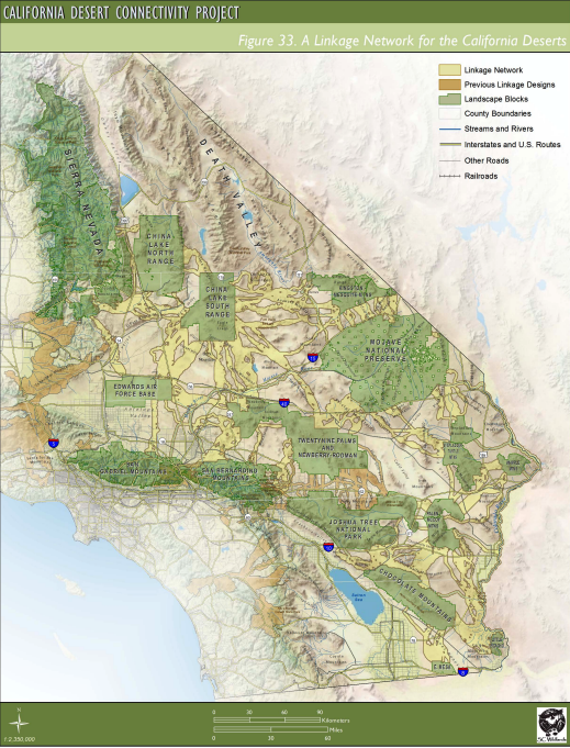
As noted in this report: Movement is essential for species to shift their geographic range in response to global climate change. Protecting habitat connectivity to facilitate such movement is critical to allow species to 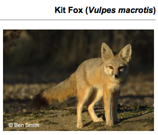 adapt to climate change. To inform such protection, this study examines 22 linkage planning areas to identify least-cost habitat corridors - areas of habitat connecting species populations which provide the greatest protection at the least cost to human activities. These primary Linkage Networks or corridors identified are based on current conditions and distributions for four focal species especially sensitive to habitat fragmentation including the American badger, kit fox, bighorn sheep, and desert tortoise.
Because climate change may alter the effectiveness of these corridors, this study additionally conducted land facet analyses to identify connectivity areas most likely to be effective under future climatic conditions. Corridors may also be based on land facets - which are considered enduring features such as lowland flats or steep north-facing slopes - to provide a climate adaptive conservation strategy.
The land facet corridors supplement the focal species corridors to create a linkage network designed for new climatic conditions. Potential habitat and connectivity/linkage networks are mapped for each of the 44 species considered in this study. The report individually profiles the four primary species as well as the other 40 focal plant and wildlife species and their distribution status, habitat associations, and spatial patterns. The study identifies potential future habitats for each species and maps this in relation to the essential corridors or Linkage Networks that are climate adaptive.
These results can help local jurisdictions, land managers, and property owners in adaptation planning and decision-making that impacts habitat connectivity and, therefore, biodiversity of these southern California deserts.
Publication Date: February 2012
Authors or Affiliated Users:
- Kristeen Penrod
- Paul Beier
- Emily Garding
- Clint Cabanero
Related Organizations:
- Northern Arizona University
Sectors:
- Biodiversity and ecosystems
- Land management and conservation
- Wildlife
Resource Category:
Resource Types:
- Mapping tool
- Project
States Affected:
