


Eastern Shore of Virginia Hazard Mitigation Plan
This Hazard Mitigation Plan profiles the counties and towns of the Eastern Shore of Virginia, including current and projected localized natural hazards and adaptation strategies for managing these impacts. The vulnerability of Virginia’s Eastern Shore to sea level rise, recurrent flooding and storm surge is discussed in detail throughout the report, along with information specific to each town as it is impacted by sea level rise.
A Risk Assessment identifies the primary hazards and associated risks that threaten the region, and mitigation options for each hazard. The highest hazard priority rankings are for: high wind, coastal erosion, coastal flooding, and storm water flooding - and a chapter is dedicated to each with background information, historical accounts, and descriptions of potential damages and vulnerabilities.
Hazard mitigation or resilience solutions for the region and each local jurisdiction are discussed extensively in this nearly 600 page report. Short and long-term goals as well as immediate actions to guide priority decision making and project implementation are provided. These recommendations address sea level rise and more specifically localized nuisance flooding and storm surge events. Mitigation goals, strategies, and detailed descriptions of ongoing or planned projects for meeting these goals are provided for the region's two counties - Accomack and Northampton - and for the Town of Chincoteague at the end of the report.
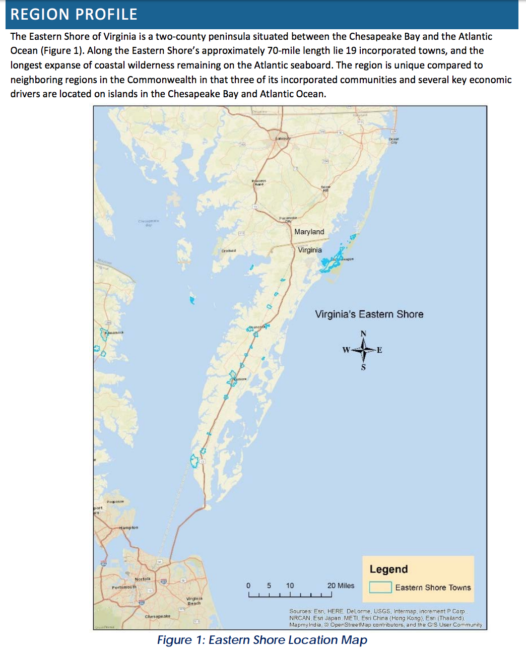
Chapters 11 through 26 are profiles of every Town of the Eastern Shore that took part in the planning process, including the Towns of:
- Bloxom
- Cape Charles
- Cheriton
- Chincoteague
- Eastville
- Exmore
- Hallwood
- Keller
- Melfa
- Nassawadox
- Onancock
- Onley
- Parksley
- Saxis
- Tangier
- Wachapreague
The profiles provide a general description of the community including geographic, physical, demographic, and economic characteristics; along with land-use patterns, historical disaster data, and building characteristics. Socio-economic conditions are also described for each town - recognizing that everyone is not affected equally by natural or climate hazards. The demographic factors assessed include age, mobility, income and the languages individuals speak.
The Counties of the Eastern Shore of Virginia - Accomack and Northampton - are also profiled in the report with baseline information on environmental and economic elements at the county level that can determine hazard vulnerability. Maps for each county illustrate local areas expected to be impacted by the highest priority hazards.
Publication Date: 2016
Related Organizations:
- Virginia Department of Emergency Management
- Accomack-Northampton Planning District Commission
Sectors:
Resource Category:
Resource Types:
- Plans (other)
States Affected:
Impacts:
