


Frederick County, Maryland: Floodplain District Standards
This resource is part of a collection of research on Local Ordinances for Climate Adaptation & Mitigation developed by Georgetown Climate Center. See more related resources.
Frederick County, Maryland established a floodplain district and codified restrictions on development activity within that district. Section 1-19-9.110 of the Frederick County Code of Ordinances most notably details both enhanced setback standards and freeboard standards.
All counties within Maryland participate in the National Flood Insurance Program (NFIP), and are therefore required to develop a floodplain management ordinance which incorporates minimum federal standards. Frederick County must also abide by Maryland state standards, which require state level permits for activities in the 100-year nontidal floodplain and activities within 25 feet of nontidal wetlands.
The Frederick County Code §1-19-9.100 establishes the Floodplain District as a zoning overlay district, meaning that regulations applying to the Floodplain District are supplementary to the regulations and restrictions of the underlying zoning designation. The Floodplain District is defined to encompass the most extensive of three areas: the mapped FEMA floodplain, flooding soils, and wetland areas. Flooding soils are determined by Frederick County and wetland areas are determined by the Maryland Department of the Environment. The Flood Insurance Study (FIS) and accompanying Flood Insurance Rate Maps (FIRMs) for Frederick County were last updated in August, 2023.
Figure: Frederick Critical Facilities and 100-Year Floodplain
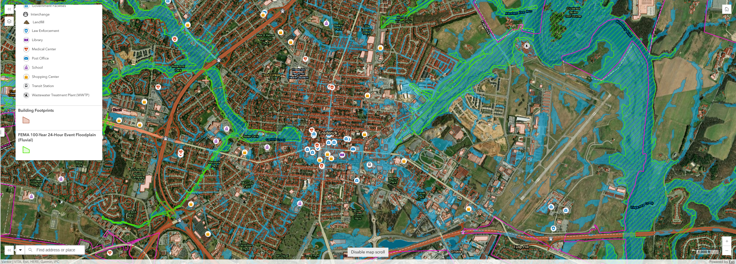
Caption: Fluvial (green lines) and pluvial (blue shading) 100-year flood events for Frederick, Maryland. Icons indicate different critical facilities. Source: Frederick 2022 Hazard Mitigation Plan Update Story Map.
Enhanced Setback Standards
At a minimum, Frederick County requires a setback of 25 feet from the Floodplain district boundary unless overridden by a separate flood mitigation process. This process requires an applicant to submit geotechnical and soil reports prepared by certified professionals as well as a flood mitigation plan to address temporary inundation, run-off, and groundwater recharge. The Frederick Community Development Division determines what areas within the floodplain district boundary are buildable and reviews mitigation plans for approval.
The county also requires a setback of 50 feet from the bank of any perennial or intermittent stream. For areas designated as a special flood hazard area (areas with a 1% chance of flooding annually) the minimum setback is 100 feet. The county’s ordinance additionally requires that all setback areas be maintained with natural vegetation.
Freeboard Standards
Frederick County also established enhanced freeboard standards by including an additional factor of safety beyond the 100-year floodplain that buildings must be elevated to. Buildings that are being replaced, relocated, or substantially improved must ensure that the lowest floor is elevated 1 foot above the 100-year floodplain elevation. The code defines the “lowest floor” as “the lowest floor of the lowest enclosed area, including basement.” However, basements are prohibited from development in the FEMA floodplain.
Publication Date: May 23, 2023
Related Organizations:
- Frederick County, Maryland
Related Resources:
Sectors:
Resource Category:
Impacts:
