


Laurel, Maryland: Code Article IV. - Floodplain Management
This resource is part of a collection of research on Local Ordinances for Climate Adaptation & Mitigation developed by Georgetown Climate Center. See more related resources.
On April 25, 2016, the City of Laurel, MD, adopted Article IV (Floodplain Ordinance) to their city’s Unified Land Development Code, which outlines building and structure regulations in the floodplain, including elevating critical facilities to the 500-year flood level and enhancing flood protection setback standards. About 10 percent of the city of Laurel is located in the floodplain, at risk of flooding largely from the Patuxent River. Flooding is considered the most significant natural hazard in Laurel, as the city is vulnerable to flooding in many forms: riverine, creeks, localized flooding, and dam failure. The special flood hazard area is defined as the land in the floodplain subject to a one-percent or greater chance of flooding in any given year.
The floodplain ordinance also acknowledges the role of climate change in increased flood risk and vulnerability, defining the flood protection elevation as the base flood elevation plus two (2) feet of freeboard, which is a “factor of safety that compensates for uncertainty in factors that could contribute to flood heights greater than the height calculated for a selected size flood and floodway conditions,” such as climate change.
Figure: City of Laurel, MD Flood Zones
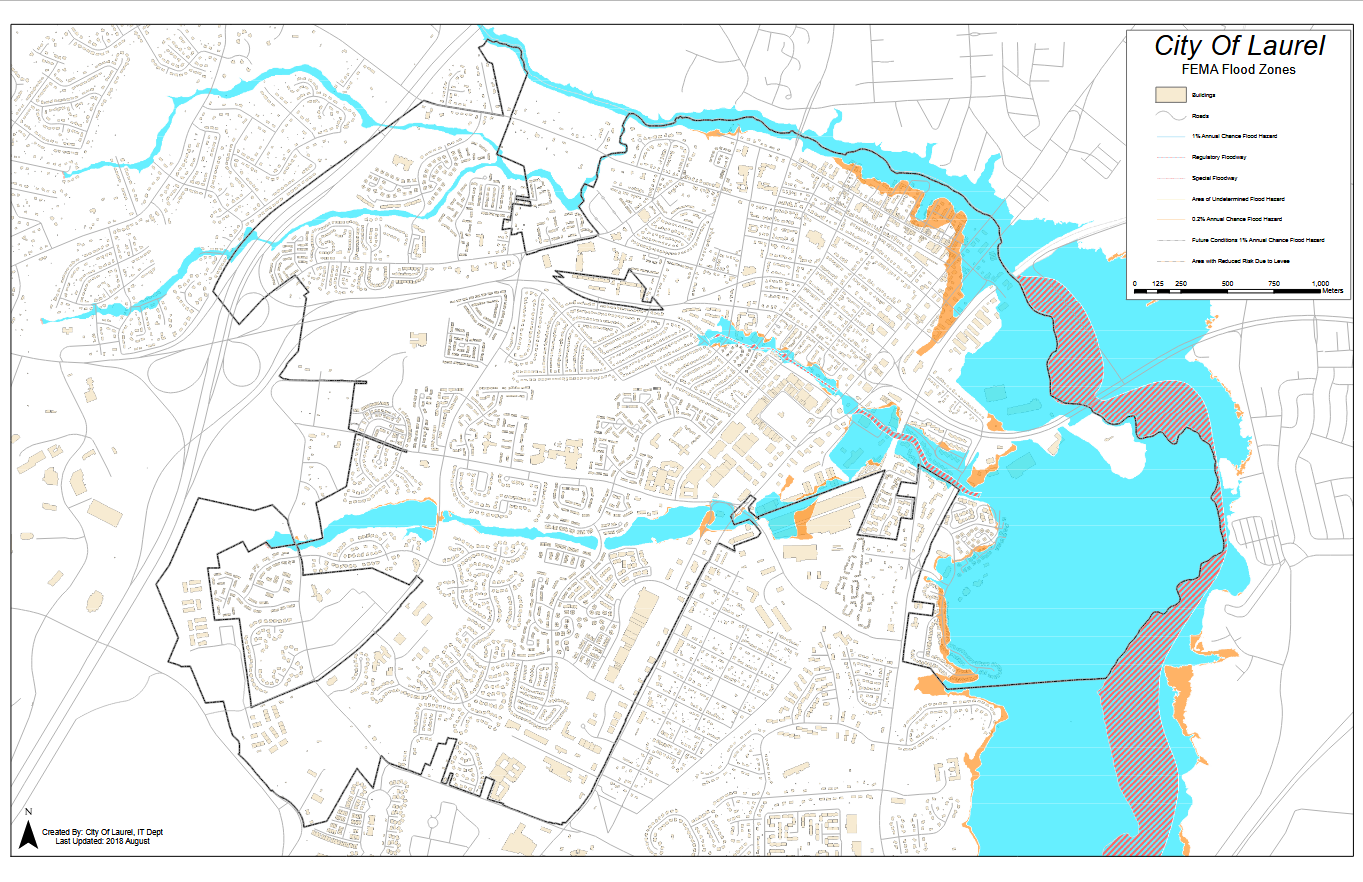
Image Caption: Map of flood zones across the city from the FEMA Flood Insurance Rate Map in 2018.
Enhanced Setback Standards & Mapping
Article IV requires that, along nontidal waters within the special flood hazard area, the flood protection setback from a watercourse is 100 feet. This requirement does not apply if the setback extends beyond the boundary of the flood hazard area. For watercourses outside the special flood hazard area, the minimum required setback distance is 50 feet.
Freeboard Standards
The code also regulates floodplain protection for critical and essential facilities, such as hospitals, fire stations, police stations, and facilities that handle or store hazardous materials. These facilities must be elevated either to the 0.2-percent change (500-year) flood level plus one foot, or the elevation required by the Laurel Building Code (Code of Ordinances, Chapter 18) plus one foot (whichever is higher). Additionally, the ordinance requires that electric panel boards in buildings and structures must be located three feet above the base flood elevation, which is designated by the 100-year flood level.
Publication Date: April 25, 2016
Related Organizations:
- City of Laurel, Maryland
Related Resources:
Sectors:
Resource Category:
Resource Types:
- Laws
States Affected:
Impacts:
- Flooding
- Coastal Flooding
- Riverine Flooding
